Categories
Uncategorized

Vanderbilt University Center for Digital Humanities Internship Final Reflection

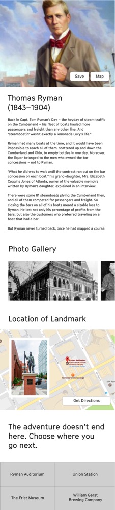
My internship this summer with the Vanderbilt Center for Digital Humanities could not have been better. I had the opportunity to learn from Dr. Mickey Casad and other scholars and digital directors at Vanderbilt. They included Juliet Larkin-Gilmore, Dr. Angela Sutton, Dale Poulter, and Dr. Steven Wernke.  I also had the chance to meet and collaborate with scholars from other institutions such as Dr. Chad Berry (Berea College), Dr. Reavis Mitchell (Fisk University), Dr. Lea Williams (Tennessee State University), Dr. Van West (Middle TN State University), Dr. Molly Taylor-Polesky (Middle TN State University), and Dr. Carole Bucy (Volunteer State College). Finally, I had many meeting with community stakeholders related to the Nashville Sites Digital Project including Nashville Public Library, Metro Archives, TN State Library and Archives, Slave Societies Digital Archive (Vanderbilt), Fog Haus, Metro Historical Commission, Belmont University, Middle TN State University, Convention and Visitors Corp., Smithsonian Institute, Humanities Tennessee, and more.

All of that to say, it has been a joyful internship. My experience has  provided me with new digital skills (particularly after meeting with Dale Poulter last week about Fedora and Islandora), while also allowing me to flex my own (digital) muscles. Not only has Dr. Casad and the center supported my work with Nashville Sites, I will also have the chance to give back in two weeks–as I lead a workshop at the Vanderbilt DH Bootcamp. I will be teaching a session on Omeka to Vanderbilt faculty. In terms of Nashville Sites, I am happy to report that just yesterday, I passed off all metadata and tour narratives and maps for the first five tours. They are: Downtown School and Education, Food for Thought (restaurants either historic themselves or in historic buildings), Civic and Public Spaces, Architecture Highlights, and Nashville’s Seedy Side.

This summer I put much of the knowledge gained through George Mason University coursework into action. That is perhaps the best part. My coursework at GMU inspired my work with Nashville Sites, which in turn has allowed me to turn this class project into “a real thing,” and has also led to me learning many new things on my own and from others connected to the Vanderbilt Center for DH. I can’t thank Dr. Casad and Dr. Platt enough for their encouragement, guidance, and support.

A final word of thanks to George Mason for giving me the skills and experience to expand my professional portfolio. This past year, I led a Digital Humanities Initiative at Harpeth Hall, which resulted in my work with at least one teacher in every academic discipline (except math) to develop a digital project. My work in Digital Humanities also played a big role in my recent one-year appointment as Professor of Practice at Belmont University next year. Dr. Mimi Barnard’s vision and ingenuity made this appointment possible.  I will be teaching an intro to Digital Humanities course as well as work with students on Nashville Sites (also two additional courses). In sum, Belmont is hosting me as I teach and work on this project. Two years ago, I could not have imagined that this certificate program would lead to a new position.

Below, I will share part of one of the completed tours as a sample. I will not send metadata as it is still being edited, and the GIS is under construction. I look forward to sharing the actual site when it is launched (estimated date August 2019). There should be approximately twenty tours. Enjoy.

1. The Hermitage Hotel/Capitol Grille/Oak Bar

J. Edwin Carpenter’s 1910 Hermitage Hotel is designed in the Beaux Arts Style, and even if you choose not to eat here, a visit inside is worth your time. Along with the ornate lobby and restaurant, the Art Deco men’s restroom located near the Oak Bar is famous for its design. Ladies, you can check out the restroom as well, just ask the hotel staff.
    
In the months before Tennessee’s decision to ratify the Nineteenth Amendment (August 18, 1920), both proponents and opponents of woman’s suffrage established headquarters at the Hermitage Hotel. They chose the location for its proximity to the capitol building, where women could not hold office but could lobby for their causes. After a fierce political battle, Tennessee became the thirty sixth state to ratify the amendment, which met the 2/3rd state threshold needed, granting women the constitutional right to vote. Tennessee is still called the “Perfect 36” for its role in the ratification process.
 
The Capitol Grille, originally called the Grill Room, once served clear green turtle soup, Tennessee squab, celery, and salted almonds. While these dishes epitomized fine dining in the early twentieth century, they no longer exist regularly on the menu. Even though food tastes change over time, Capitol Grille has continued its long-standing tradition of using locally sourced ingredients when possible. The hotel owns Double H Farms that raises free range cattle and uses seasonal vegetables grown at historic Glen Leven Farm. If you don’t want a full meal, unwind in the Oak Bar, originally an exclusive men’s club. Today all can enjoy this space, which has served drinks and dinner for over a century. 
 
Move southeast on Sixth Ave. toward Church St, and turn LEFT onto Church St. Then, turn LEFT onto Fifth Ave N to reach 227 Fifth Ave. North. Woolworth on 5th is about halfway up the block. Along the way, you will pass buildings with historical, architectural, and artistic significance. On Sixth Ave. North, take note of the Herakut mural of the dog, created through the Nashville Walls Project. Church Street is full of important sites including the Nashville Public Library, 505 Nashville, and the Downtown Presbyterian Church, which you pass on your right as you walk toward Fifth Avenue. 
Additional Info: Hermitage Hotel Audio

2. Woolworth on 5th

In February 1960, a group of black students from Fisk University, Tennessee A&I (now Tennessee State University), and American Baptist College boldly sat down at the lunch counters of Woolworth’s, Kress, and McClellan—all department stores. This is how Nashville’s sit-in movement began. Implementing methods of non-violent protest, young Civil Rights leaders such as John Lewis, James Lawson, and Diane Nash began a historic journey to end racial segregation. In the face of violence, intimidation, and arrest—the determined spirit and perseverance of these and other students led Mayor Ben West to support desegregation. He did so, and the Nashville business community followed by integrating lunch counters, stores, and restaurants. By the summer of 1960, Nashville had desegregated all public facilitiesthe first southern city to do so.
After a major renovation, the Woolworth building reopened as a restaurant in early 2018. The venue hosts a “welcome table for all,” showcasing the Civil Rights movement in Nashville through historic photographs and visibly patched floors where the segregated lunch counters were removed. Visitors can enjoy live jazz, R&B, early rock, and more while dining.
Woolworth’s reflects the power of food to connect the past to the present and to provide a window into the complicated nature of southern culture and identity. You can likely think of popular foods associated with the American southeast: barbecue, fried chicken, or biscuits. These dishes represent points of contact between Native Americans, African Americans, and European Americans. These popular dishes reveal stories about women and men, many enslaved, who cooked for others and adapted foods during times of plenty and times of need. As you explore Woolworth on 5th, consider how its “welcome table for all” unites not only those who challenged Jim Crow with the present, but also celebrates the different races, classes, and cultures who made the cuisine we know and love today.
Turn LEFT outside of Woolworth on 5th; after walking about thirty yards, turn RIGHT at the Fifth Ave. North crosswalk to reach The Arcade located across the street. When you leave Woolworth’s you will see a historical marker describing the sit-ins. 
Audio about Civil Rights Movement sit-ins in Nashville, TN
Link to webpage: http://digital.library.nashville.org/cdm/singleitem/collection/nr/id/689/rec/17
  • Oral History Interview with Edward F. Jones, 2006 November 3, excerpt 17, is a three minute clip of Jones describing the sit-in movement in broad terms. He mentions student activism, and the negotiations between business owners and student activist leaders. 
  • Citation per NPL:                                                                                                             Edward F. Jones, Series 1, The Turner Interviews, Nashville Business Leaders Oral History Project, Special Collections Division, Nashville Public Library.

3. The Arcade (and Peanut Shop)

If you seek a variety of options and a quick meal, drink, or snack—Nashville’s Arcade, located across the street from Woolworth on 5th, is the place for you. For decades, Nashvillians saw Fifth Avenue as the most popular shopping area in the city. At its peak in the early twentieth century, department stores lined the street, and the Arcade was the center of it all. 
Running though the middle of the block between Fourth and Fifth Avenues, this space was originally a rose garden called Overton Alley. In 1903, Daniel C. Buntin funded the construction of a two-story indoor shopping venue designed by the architectural firm Thompson, Gibel and Asmus. Modeled after the famous Galleria Vittorio Emmanuele in Milan (Italy), the Arcade features a glass-gabled roof, reinforced with steel beams made in East Nashville. When the city celebrated the Arcade’s opening, approximately 40,000 people gathered for shopping, music, and mingling. Shop owners and businesses in Nashville’s Arcade have changed over time, and the second floor mezzanine currently boasts art galleries that participate in the free Downtown Nashville First Saturday Art Crawl. 
The street level promenade offers over twenty food stops with pizza, deli sandwiches, tacos, Chinese food, coffee, pastries, and more. The plethora of affordable options allows customers to find the perfect meal while taking in the architecture of this hidden gem. The oldest store in the building, The Peanut Shop, opened in 1927. Owned by Planters Peanuts until 1960, the store has run independently for over fifty years. Much of the decoration here is original, so make sure you look around if you stop in for a treat. 
After walking STRAIGHT through the Arcade, you arrive on Fourth Ave. North and see the Bobby Hotel directly across the street. Turn RIGHT and you will see a crosswalk which you will take to get to the other side of the street. The small road in front of you that separates the Bobby Hotel from the Southern Turf building is called Metro Alley. The Southern Turf building, the historic location of your next stop, is on your RIGHT. Take the alley to Skull’s Rainbow Room restaurant and bar, located in the back of the Southern Turf building. 
Categories
Uncategorized

Vanderbilt Center for Digital Humanities Internship Update, July 2018

Over the past month, I have stretched my DH skills in many areas. I have learned from and collaborated with scholars and continued to lead and manage a digital project moving from the conceptual phase to the development phase. Along the way I have been challenged, encouraged, and inspired. Challenges range from logistics and subject/keyword indexing to defining a public and digital history philosophy. There are three projects that I would like to highlight in this blog post. I sincerely thank all three scholars for meeting and sharing their exciting work in DH with me.

Fort Negley Descendants Project

In particular, I enjoyed meeting Juliet Larkin-Gilmore, a Digital Humanities Fellow and PhD candidate in history at Vanderbilt University. She introduced me to the Fort Negley Descendants Project. Juliet and I are meeting next week to discuss how her work might intersect with Nashville Sites. Last year, Dr. Mickey Casad, the Associate Director of the Center for DH, formed a working group called Black Nashville, which is comprised of graduate students and scholars from all of Nashville’s major universities. One member of this intercollegiate group, Dr. Lea Williams, is also a consulting scholar on Nashville Sites.  Dr. Williams is a Professor of History at Tennessee State University. He will be managing the tour content and design for a tour entitled, “Antebellum Black Life,” and it is my hope that Juliet and her team will work with Dr. Williams to build this tour.

Here is an excerpt of the project:

The Fort Negley Descendants Project is an oral history digital archive aimed at preserving the voices and stories of the descendants of the African-American laborers and soldiers who built and defended Fort Negley. The Fort was built in 1862, using a combination of forced labor of enslaved Africans which the Union army in Nashville had rounded up from nearby plantations, and free blacks of Nashville and the surrounding areas, who offered their services in exchange for payment (much of which never materialized). . . . Once built, the fortification was defended by various regiments of the United States Colored Troops against the Confederate forces. Both builders and defenders died in record numbers at Fort Negley in the defense of our union. Recent ground-penetrating radar reports have indicated a high likelihood that their remains still lie on the grounds of Fort Negley Park.

After the war, those who survived settled the nearby historically black neighborhoods of Chestnut Hill, Wedgewood Houston, historic Edgefield, and Edgehill. At the turn of the century, several prominent families from these neighborhoods founded North Nashville and all of the prestigious black institutions residing there- the historically black colleges, businesses, and churches. In the 1950s, these same institutions trained and supported some of the sharpest minds of the Civil Rights movement. There is a long and unbroken connection between the builders and defenders of Fort Negley, and Nashville’s current African-American population.

GeoPACHA

A second scholar I met with through the Vanderbilt Center for DH was Dr. Steven Wernke. Dr. Wernke is working on an exciting geospatial and crowdsourcing project called GeoPACHA project.  An Associate Professor and Director of the Spatial Analysis Research Laboratory in the Department of Anthropology, Dr. Wernke also works on a team that is part of Vanderbilt’s Initiative for Interdisciplinary Geospatial Research. Dr. Parker VanValkenburgh, Assistant Professor of Anthropology at Brown University, is the other project manager for GeoPACHA. This project utilizes prgrams such as Spatial Lite, Arc Collector, and Q-Field (Android only). Below find selected excerpts about the project:

GeoPACHA (Geospatial Platform for Andean Culture, History and Archaeology) is a browser-based, edited geospatial platform for discovering and mapping archaeological sites in the Andean region of South America. It is designed to facilitate the identification of archaeological sites through “virtual survey” of satellite and aerial imagery and consists of a simple browser-based interface that enables users to visually scan imagery and plot the locations of archaeological sites to a central GIS database using point themes. GeoPACHA also enables the registry of attribute data with site locations via form-based data entry. A grid-based system tracks coverage and sites are recorded.

As is the case for any form of crowdsourced data, quality control is one of our paramount concerns. GeoPACHA’s tiered editorial model is designed to facilitate control of site identifications and attribute data to create high quality, curated datasets. Initial site locations and attributes entered by registered contributors are saved to a queue. Regional editors then conduct initial review of site identifications and attributes. General editors conduct a final review before committing site location and attribute data to the canonical database.

Sponsors for GeoPACHA

Dr. Wernke and I plan to meet in late August to see how his Intro to GIS class might contribute and participate in the Nashville Sites Project.

Mappalacia

The third scholar I met was Dr. Chad Berry, Academic Vice President and Dean of the Faculty at Berea College. He is in the process of reviving a digital project, called Mappalacia, that he began as a Professor of History before moving into administration. The digital project was born out of an interdisciplinary project involving the Art, Music, and English Departments, which ran from 1948 through the 1980s. Before getting into the original project and digital project, one must first understand the distinctive mission and history of Berea College. From its website:

Founded in 1855 as the first interracial and coeducational college in the South, Berea College charges no tuition and admits only academically promising students, primarily from Appalachia, who have limited economic resources.  Berea’s cost of educating a student for four years is nearly $100,000. A majority of Berea’s students are from the Appalachian region, and while all students are highly motivated their backgrounds are quite nontraditional compared to most college students. Berea College offers rigorous undergraduate academic programs leading to Bachelor of Arts and Bachelor of Science degrees in 28 fields. All students work at least 10 hours per week in campus and service jobs.

Here is a description of the original “Man and the Humanities” project:

Art professor, Dr. Les Pross, taught an interdisciplinary class called “Man and the Humanities.” On the first day students were given a 8.5×11 inch sheet of paper. The assignment had one instruction: Draw or map your community. Student returned the following week with their drawing and an archive was born as Dr. Pross saved each drawing after the term and drawings/maps were dated, filed, and stored.

When Dr. Berry came upon this collection, he saw an opportunity. First he began by digitizing the maps–mostly from the 1960s, 1970s, and 1980s. Second his classes analyzed them and began creating mental maps and discussed points of intersection and connection (nodes, paths, segments), issues of memory, variances in visual representation, and historic periodization. There were many issues with which students grappled. For example, many of these views and features no longer exist because of coal industry, interstates, post-industrial development or rather decline. In revamping the Mappalacia digital project, Dr. Berry hopes to provide a window into Appalachian culture, as well as international and national culture from other home regions of students during these years.

Observations of Dr. Berry’s class included:

  • Gender: Male student drawings tend to be more aerial, women more grounded or landscapes
  • Race: Sometimes portrayed with railroad tracks, even sometimes labeled, e.g. “Negro” homes or otherwise portraying geographical segregation
  • Class: Also represented on many maps representing higher ground for upper class, lower ground for working class
  • Other themes, community, industry, lots of railroads, mines

I hope to meet with Dr. Berry again to see how I might contribute to this project moving forward as he also determines the best course forward for taking this project to the “next level.”

All in all, these meetings and exposure to scholarly DH projects allowed me to see many other possibilities for the wide-range of subjects, scope, and meaning for the Digital Humanities for students, for potential users, and for the larger, common good.

Additional Reference:

Bill Rankin, After the Map: Cartography, Navigation, and the Transformation of Territory in the Twentieth Century, University of Chicago Press, 2017.


Categories
Uncategorized

Vanderbilt Center for Digital Humanities Internship Update, June 2018

My summer internship with the Vanderbilt University of Digital Humanities has been very fruitful thus far. Working primarily with the center’s associate director, Dr. Mickey Casad, the internship promises to be beneficial in a variety of ways. First, the Center for DH is providing in-kind support for Nashville Sites — of which I am the project manager. This allows me to expand my digital skills while also working on a project already in progress that will continue beyond this semester. Dr. Casad and I have met twice to talk about this as well as other initiatives and projects connected to the center. These projects include Mappalacia, with Berea College, and Fedora, with Dale Poulter (VU Director of Library Technology and Digital Services). I will have more to report on these projects in my next post.

Most of May and June was spent working with a staff of four on the initial five tours for Nashville Sites. There are many challenges in building a digital infrastructure, content management system, navigation, and taxonomy. The first five tours are are located in a centralized area of downtown because we wanted to keep our geographical parameters tight as we worked through certain issues. They include: architectural highlights, seedy side (Nashville’s former red light district), food for thought (restaurants in historically significant buildings), and downtown schools/education. My assigned tour was downtown schools/education. Mapping out the tour, doing the research, collecting metadata for individual records, and writing a tour narrative took quite a bit of time. Also valuable to the process was physically walking and “testing out” the tour. I realized that many sites on other tours are visible on mine, and so we’re working with our web designers to determine how best to alert the user to these sites in order to provide the option of a customized or deviated tour. Here is my final tour, which includes the following stops:

1. Tennessee State University
2. Nashville Female Academy
3. Nashville School of Law/YMCA
4. Ward Seminary
5. Hume-Fogg School
6. Lipscomb University Downtown Spark Campus
7. Hatch Show Print
8. Taylor Swift Education Center
9. Walk of Fame (Local Alums and School Connections)
10. Seeing Eye (First Dog Training School for the Blind)

The tour is 2 miles long and takes approximately 75 minutes if walked without more than five minutes spent at each site. Other considerations included accessibility (sidewalks, ramps, lighting), balancing active sites versus historic markers only, and creating a subject/keyword/tag hierarchy. The subject list is still a work in progress, but we are basing it on the Omeka’s Simple Vocab plug-in. Specific methodologies and skills learned through GMU coursework have been key to working on this project: Omeka, copyright, Google Maps, using images, history based on place, creating personas, and even Slack. I look forward to the next few weeks as this and other work/projects through the VU Center for DH develop.

Categories
Uncategorized

HIST689 Introduction

I am looking forward to taking HIST 689 with Dr. Kelly as the final online course for the post-graduate certificate in Digital Humanities through George Mason University.

In the first two courses I gained a real sense of the trends, direction, and scope of Digital Humanities. In addition to technical expertise, the courses also provided meaningful readings and activities. I hope that this class will further add to this new base of knowledge and skill.

Professionally, I juggle several different roles. I am a secondary school educator at the Harpeth Hall School where I also serve as the archivist. I also teach as an adjunct at Belmont University in the Honors program as well as the Global Leadership studies department. Most recently I taught an interdisciplinary class entitled “Making the Modern City.” In the last several years, I have also added author to my list of professional achievements. This fall will bear the fruit of two and a half years of research and work with the release of two books. Athens of the New South: College Life and Making Modern Nashville will be published by University of Tennessee Press and A Heartfelt Mission: A History of the West End Home Foundation published by Orange Frazer Press. Adding my GMU coursework on top of my day job and writing this past year was a challenge but well worth the time and effort. Next year I will add Digital Humanities Coordinator to my list of duties at Harpeth Hall, and I will be continuing the development of my project from Dr. Leon’s class in partnership with the Metropolitan Historical Commission. The project, Nashville Sites, will be modeled on the History of the National Mall project and will initially launch this fall with continued development (and funding, fingers crossed) in 2018.

I look forward to this course, and I hope to find a way to incorporate and tailor my work in HIST694 to further Nashville Sites as well as my work with teachers (as Digital Humanities Coordinator) at Harpeth Hall.

Categories
Uncategorized

Final HIST694 Post

It is time to close out HIST694 with a final blog post about building the prototype for Nashville Sites and doing public history.

Having just put the finishing touches on this version of my course project, I feel comfortable reflecting on the experience as a whole. I think that this course and this project has enabled me to realize the full potential of doing digital history. From developing personas, a social media strategy, and an evaluation plan to building content, metadata, and walking tours–this digital project has been both challenging and rewarding. At times this project felt like a sprint, other times it felt like a marathon. In reality, most projects dealing with large amounts of information (whether a book or a digital prototype) are both.

Perhaps most exciting is the continuation of this project beyond the semester. As I mentioned in my screencast video, this project started with an idea inspired by the Histories of the National Mall.

While I ran into technical problems with using the “mall theme” I continued my course project by creating a prototype using the Berlin Theme in Omeka. I also used Neatline to build two walking tours: Upper Broadway and Lower Broadway. These two tours focus on different historical markers and themes that will appeal to different types of audiences. I also used Exhibit Builder to create a “Up from the Cumberland,” which is a thematic exhibit with four parts: Maps and Geography, Athens of the South, Nashville’s Acropolis, and Broadway. Each of these nested pages links and cross referencing the majority of the items in my collection. Each part of the exhibit was designed to focus on different areas related to Nashville history. Following the order above, I organized these pages to target history, and historical markers, based on several categories: geography and urban growth, secondary and higher education, government, and architecture.

I have thoroughly enjoyed the course, the assignments, and I have learned a great deal. I am more confident in my abilities as a project manager, public historian, and digital humanist. I look forward to next semester and hope that the course is designed in a way that I can continue this work.

Categories
Uncategorized

Project Progress 4/9-4/15

I have made great progress on my dual Nashville Sites projects. For the HIST694 project I have been adding content, building my exhibit, and have completed my first walking tour. Over the next week, I hope to finish the content for my exhibit, map out my second and final walking tour, and add 5-6 more items with Dublin Core info. So I should be in good shape for submitting the project for peer review and feedback at the end of next week.

The larger and permanent digital project is also moving forward. I received the bid from Fog Haus for Stage One of development to get a “Mall Histories” type site up and running by the end of the summer. I worked with Nick Lorenson to create narratives that will add a storytelling element to the project, and his firm mocked up a potential layout (see below). We are also discussing the use of BKON, which would alert users that they are near a historical marker using push notifications on smart phones. I made my presentation this past Thursday evening to the MHC Foundation Board, and they voted to approve funding for half of the Stage One amount. I will go with Tim Walker, MHC Director, to our local visitor’s bureau and another non-profit organization called Community Partners to secure the rest of the funding. The feedback was extremely positive, and I am confident that Nashville Sites will become a reality, just not this semester. I hope that our final online course through GMU will allow me to continue working on this project as part of my coursework.

Categories
Uncategorized

Project Progress 4/1-4/8

What a week! I have several new developments to report as part of my project progress for this week. I will break it down into three parts as there are now multiple strands related to progress on Nashville Sites.

  1. As I mentioned in an earlier progress report, I made the decision to separate the class project for HIST694 from the actual project that I hope will go live sometime between August and November 2017.  While I started this process wanting to build something that could be developed after the semester, I realized that it would actually be easier to build my digital project for the class and then work to migrate the content into a more desirable (mobile-friendly) customized theme and design layout. In other words, for this class, the content remains most important and so I should spend my time on that while simultaneously working to make the actual final project a reality. This weekend, I’ve spent a great deal of time on the course project and have finally made some headway.  I’ve set up the framework for a thematic exhibit with nested pages. I have also decided to use Neatline rather than Curatescape to create my walking tours. After running into several technical glitches with Curatescape, I found that Neatline serves my purposes just as well, although I wish I could find a way to list the walking tours in one of the text boxes on the homepage rather than just a tab. I’ve not yet seen any way to do this, but perhaps there is a workaround. I still have content to add, but I now have my first (of three) walking tours set up and mapped.
  2. In terms of Nashville Sites beyond this course, I also have progress to report. After meeting with Nick Lorenson of Code Nashville, nearly three weeks ago, we had a great meeting last week. After looking at several existing sites (based on place) that we would like to model in some way (Philly, Cleveland, Mall Histories, WWI: Love and Sorrow) as well as looking at the capabilities of themes, plug-ins, etc., Nick proposed three options. We could continue with Omeka and try to update the existing Mall Theme. We could also continue with Omeka but build a new theme. Finally we could use WordPress instead of Omeka because it would be easier to find technical support and local contacts who could help. He concluded that while he is unfamiliar with Omeka that from the back end it is something that he would be comfortable working with and that it seems to be better suited to accomplish the project’s goals (user-friendly, engaging, educational, scholarly sound). That led to a second meeting, which I had this morning. The meeting was with Fog Haus, a computer/web engineering firm. It is a small firm and includes Nick and two partners. We had a great meeting. They are enthusiastic, visionary, and can do the technical “stuff” that I cannot. We spent a great deal of time going through sites, looking at options, and coming up with a plan. This course sure has come in handy as we discussed responsive design, audience, personas, and storyboarding. I shared with them several of the assignments that I have completed for this course! (And they are very impressed might I add, so thank you Dr. Leon.)
  3.  So where does all this go from here? Following my meeting with Fog Haus, they are working on a bid to design and build the project. I just got off the phone with Tim Walker (MHC director) and continue to have his full support. I am slated to present my project to the MHC Foundation in a week at the quarterly board meeting. So I am anxious to get the bid from Fog Haus and equally anxious to see if the MHC Foundation will/can fund it. As for the course project, now that I have it off the ground I need to continue to build the content as related exhibits, and walking tours. I hope to have more time to do so in the coming days.
Categories
Uncategorized

Digital Public History: Place and Mobility

What a timely module for me as I continue to develop my project, Nashville Sites. The process in thinking about and executing this project mirrors the complexities of doing digital public history specifically tied to a place. In my case — that place is Nashville, Tennessee.

Our readings discussed the use of Storyteller (World War One: Love and Sorrow), responsive design (Beyond the Screen), combining oral history and place (Cleveland Historical), and augmented reality (PhillyHistory.org).

According to Deborah Boyer and Josh Marcus, “Learning about the history of a neighborhood in a classroom is educational, but actually standing in a neighborhood and comparing historic images to the present landscape can inspire students to engage more deeply with the past” (“Implementing Mobile Augmented Reality Applications for Cultural Institutions”). I couldn’t agree more. Speaking of more, my goal for Nashville Sites also includes a public audience in addition to students and scholars. Further sub-dividing, my audience is also composed of Nashville residents as well as a wide range of visitors to the city.

The Cleveland Historical site is nearly identical to Spokane History and feature walking tours and geo-spatial mapping. However, they are not as engaging for the mobile user. The text is lengthy and rather than giving the user the opportunity to view the site with a lead-in line to draw them to the longer description, the only option is to view the longer description. It also lacks the navigability and mapping options utilized by the Histories of the National Mall.

The PhillyHistory is a much bigger project that involves augmented reality using historic photographs in real-time and place. They began with a small sample size but have now incorporated thousands of images. This project involved a system called Layar. It was interesting to think about the two categories of applications: GPS-based and computer-vision based. As authors Boyer and Marcus note, “GPS-based applications make use of a phone’s GPS and accelerometer, gyroscope, and other technology to determine the location (particularly in urban areas), heading, and direction of the phone.” Most impressive has been the response to PhillyHistory (and this article was published in 2011): the site has 6,400 registered users and regularly receives and average of 13,000 unique visitors per month. These metrics remind me that I need to circle back to the MHC to see just what the stat counters say for the nashville.gov site that lists Nashville’s historical markers. The director told me it had the most traffic, but I need to get firm numbers.

World War One: Love and Sorrow is place-based public history but focused on a different type of location. Rather than an urban environment, it seeks to create a unique user experience in Museum Victoria. It does a nice job of storytelling and creating an engaging narrative as users can progress through the museum while also choosing and following one individual’s story (an actual veteran of the war) that features accompanying primary source documents. The project creates a compelling and personal narrative that makes the museum and exhibit more exciting for the patron/user.  While a great project, with some elements that made me think about how to create a compelling narrative within my own project, this place-based history is equally, if not more, thematic. The place is the museum, which drives the project technically but not theoretically.

The final article “Beyond the Screen,” was so relevant that I read it twice. It really helped inform me in thinking about my own project. I spent quite a bit of time taking notes and internalizing concepts such as graceful degradation, responsive design, progressive enhancements, and the triad: 1- What they want, 2- When they want it, 3- How they want it. John Falk’s description of the five visitor/motivation types was also extremely useful: 1- explorer, 2- experience seeks, 3- recharger, 4- professional/hobbyist, and 5- facilitator. Several museums and projects were referenced as well as new  technologies that I’ve since checked out, which include: Foursquare, Field Trip, Google Street, and Google Now. I learned a great deal from this white paper in general, but it also made me conceptualize my own project in a more objective and productive way. For example, I could easily include a guest survey to get feedback, create a journey map, and use Neatline to create a timeline that would create a chronological complement to the place-based history I am trying to create.

Audiences, and people in general, have an attention span that averages 3-12 seconds. With that in mind, I have to find a way to get the audience to the site and find ways to keep them interested. As the authors of “Beyond the Screen,” conclude: “While content is kind, if even the bride-to-be doesn’t notice her very own diamond ring in a case in front of her, it’s worth investigating new modes and opportunities that create responsive, customized experiences that entertain, engage, and enrich.”

Works Cited:

Hart, T. and Brownbill, J. “World War One: Love and Sorrow – A hybrid exhibition mobile experience.” In Museums and the Web Asia 2014, N. Proctor & R. Cherry (eds). Silver Spring, MD: Museums and the Web. Published September 19, 2014.

Baer, Brad, Emily Fry and Daniel Davis. “Beyond the Screen: Creating interactives that are location, time, preference, and skill responsive.” MW2014: Museums and the Web 2014. Published February 1, 2014.

Tebeau, Mark. “Listening to the City: Oral History and Place in the Digital Era.” Oral History Review 40.1 (2013): 25-35.

Boyer, D. and J. Marcus. “Implementing Mobile Augmented Reality Applications for Cultural Institutions.” In J. Trant and D. Bearman (eds). Museums and the Web 2011: Proceedings. Toronto: Archives & Museum Informatics. Published March 31, 2011

Categories
Uncategorized

Landscapes and Local History

This activity asked for students to experience a mobile public history site or application in the landscape for which it was created. Ironically, this is the gap my project, Nashville Sites, hopes to fill. Nashville currently has no dedicated public history site or application that is non-profit and/or educational. There are  ad-driven/free apps and subscription or purchasable apps such as “City Walks” (a global company that combines corporate sponsors and advertising). Tours and entries are based on a City Walks staff “writing team” but the site also relies on crowdsourced information by users. In Nashville, there are also a few webpages that provide local history based on locations that include Google maps, but they are not particularly mobile friendly nor scholarly.

I decided therefore to use HistoryPin instead and found quite a bit. This was a great experience for me because I have only used HistoryPin once before and it was not in thinking about Digital Humanities (and long before the Nashville Sites project idea was even conceived). Therefore using HistoryPin now, with all of these other things swirling around in my head and online — was extremely helpful as I develop my educational goals and exhibit layers for Nashville Sites. Here is the area that I surveyed both digitally and physically.

The place-based techniques of HistoryPin for the downtown core and West Nashville have many different collections. Most of the Pins were private citizens and registered HistoryPin users. The majority of the Pins were photographs taken by these users and while the photographs were great there was very little text, narrative, or metadata. Still, most of the major historical sites within the geographic parameters shown on the above map were “Pinned.” The one institutional presence I saw for several instances was the Albert Gore Research Center. Pins placed by the center included not only photographs but also newspaper clippings, political cartoons, and letters.

All in all it was an eye-opening experience and activity that helped me to see what is “already out there” in terms of place-based history in Nashville.  While there are no landscaped-based local public history projects, there is a thriving digital humanities/history program in nearby Murfreesboro at Middle Tennessee State University. For a look at what they are doing see below. They could be a potential partner in the long-run as I (and the MHC) work to develop Nashville Sites.

Digital Humanities at MTSU

Digital Humanities projects at Middle Tennessee State University are created with and for scholars. In addition to images and historical documents, projects include multimedia components, contextual themes, and lesson plans or essays. DH projects are a collaborative effort with content and technology experts who use a variety of digital tools including CONTENTdm, ArcGIS, StoryMaps, Drupal, Omeka and more. Click here for current projects.

I’m also fascinated with Curatescape and hope to use it within my own project. As I seek to develop Nashville Sites, I think about history based on place, I’ve found the Spokane Historical particularly inspiring as a model that is different from mallhistory.org but with many similarities.

Spokane Historical

Spokane Historical is a web and mobile platform for telling stories of Spokane and Eastern Washington. Spokane Historical is a project of the Public History program at Eastern Washington University. Spokane Historical is a free app available on your Android or iPhone smart phone or tablet.


Categories
Uncategorized

Oral History and Public History

Oral history has, in the words of Doug Boyd, “grown as a resource for historical and cultural documentation by both academic and community scholars” (OMHS: Enhancing Access to Oral History for Free). However, public historians, librarians, and archivists are still determining the best and most cost-effective way to publish oral histories online and making them available and navigable to the general public as well as scholars. Boyd’s work with the Louie B. Nunn Center for Oral History at the Kentucky Digital Libraries is making great strides in achieving the above goals. This is due in large part with the development of the Oral History Metadata Synchronizer (OHMS), which made its online debut in 2008. The OHMS “inexpensively and efficiently increases access to oral histories by locating precise segments of online audio or video that match a search term entered by a user” (Ibid). The OHMS system is open-source and can be linked to other course management systems and platforms such as Omeka via plug-in. OHMS and how it works is best described in a two-minute video (OHMS Tutorial) that features the following graphic:

The American Folklife Center launched the Occupational Folklore Project (jointly sponsored by the Institute of Museum and Library Services). It engages folklorists, oral historians, librarians, museum professionals, independent scholars, and other researchers according to Nancy Groce and Bertram Lyons. It is an amazing, and amazingly ambitious project that ultimately seeks to engage larger institutions including non-profit organizations, large libraries, and universities. They have divided the project’s online instructions and protocols into two parts: publicly accessible pages on the AFC/LOC website and the custom-designed online catalog IDF template (Interview Data Form). While very specific and detail-oriented, this five-step process might prevent participation because it requires some technical expertise and extensive time beyond just the interview and oral history indexing/transcription itself.

Another project that is managed by the American Folklife Center is the Veterans History Project. While the Occupational Folklore Project is still in the beta-stage, the Veterans History Project has achieved success using a slightly different, less technologically sophisticated but more straightforward model. Those interested in participating or conducting an interview simply request a Veterans History Project Interview Kit. There is also an accompanying 15-minute video tutorial (Veterans History Project). In my opinion, the Veterans History Project protocol and process is more appealing and will attract greater participation from the general public.

Digital technologies have simplified and complicated the practice of oral history. Oral history as part of digital projects is more accessible and user-friendly (for consumers and well as crowdsourcing participants) because of open-source systems and programs such as OHMS. At the same time, incorporating oral history into digital projects adds another layer of technology that must be maintained, updated, and made compatible with the larger project cms or infrastructure. While oral history is not a major focus of Nashville Sites, it could be a consideration down the road. Finding Nashvillians who witnessed a historic event or have family connections to important figures connected to the historical markers could enhance the project. It would also be a way to make the project more attractive and relevant to residents of Nashville (as a target audience).

Works Cited:

Boyd, Doug. “OHMS: Enhancing Access to Oral History for Free.” Oral History Review 40.1 (2013): 95-106. Published on March 20, 2013.

Bertram, Lyons and Nancy Groce. “Designing a National Online Oral History Collecting Initiative.” Oral History Review 40.1 (2013): 54-66. Published March 26, 2013.

css.php